


 +91-99069 96622
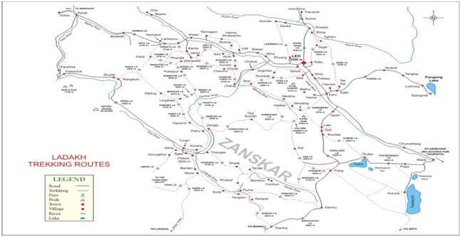
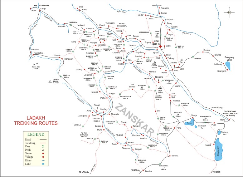
Zanskar covers an area of some 7,000 square kilometres (2,700 square miles), at a height of between 3,500 and 7,000 metres (11,500–23,000 feet). It consists of the country lying along the two main branches of the Zanskar river. The first, the Doda, has its source near the Pensi-la (4,400 m) (14,450 ft) mountain-pass, and then flows south-eastwards along the main valley leading towards Padum, the capital of Zanskar.
Zanskar situated at an altitude of 3600m. Spread over an estimated 7000sq km of mountainous territory gorges and dramatic glaciers. Zanskar is a tri-armed valley system situated between the Great Himalayan Range and the Zanskar mountains, the three arms radiating star-like towards the west, north and south from a wide central expanse. Here the Zanskar River comes into being by the convergence of its two Himalayan tributaries, the Stod/Doda and the Lingti-Tsarap Rivers. Heavy snows close in the region for almost seven months of the year and this isolation has helped preserving culture of Ladakh. There are numerous magnificent & Famous Monasteries like Lingshet, Stongde, Karsha, Sani, Dzongkhul, Rangdum, Bardan, Phugtal.


